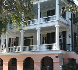
Beaufort comprised of many islands, towns and neighborhoods.
As the city expanded in the 20th century, additional growth focused on previously undeveloped areas north and west of the historic district. Much of the growth can be attributed to the increased military influence during the 1940s and 1950s, in which Beaufort’s population doubled as a result of new military personnel and families moving to the area. These areas have become integral parts of the city and today are home to the majority of the residents in the city.
Pigeon Point and Higginsonville
These neighborhoods are located immediately north of Downtown Beaufort and are built around the Beaufort National Cemetery. They contain two major city parks: Pigeon Point Community Park and the Basil Green Recreation Complex. An area with smaller homes and mostly one-story early 20th century structures, Pigeon Point has experienced a renewal of development interest, with many homes being “flipped” or renovated in recent years. Higginsonville is more similar in character to the Northwest Quadrant neighborhood and has its street names come from famous abolitionists during the Civil War era.
The West End and Depot
These areas are located west of Ribaut Road, south of Boundary Street and north of the Technical College of the Lowcountry campus. These areas have been the focus of recent redevelopment efforts. Formerly concentrated around the Beaufort rail station (the depot), the neighborhoods have similar characteristics to the Pigeon Point area and have a sizable number of military families as residents.
Spanish Point
Located between Downtown and Mossy Oaks, Spanish Point clusters around the Technical College of the Lowcountry campus and the Beaufort Memorial Hospital.
Battery Creek
Battery Creek consists of Mossy Oaks, Royal Oaks, First Boulevard, and Cottage Farms. They form the southern residential areas of the city. Battery Creek is south of the Technical College of the Lowcountry campus and the Beaufort Memorial Hospital. Some commercial establishments are hers. Residential subdivisions range from self-contained attached housing to residential estate lots of 0.5 acres .
Lady’s Island
Beaufort annexed portions of Lady’s Island without complete jurisdiction of the entire island. Most of the incorporated areas are upscale residential communities. Both Beaufort High School and the Beaufort County Airport are located on the island.
Dataw Island
Located just east of the historic waterfront town of Beaufort, South Carolina in the heart of the sea islands, the private residential community of Dataw Island offers superlative golf and tennis, a full service deep water marina, excellent club facilities and gracious homes including golf course homes, marsh front homes, and waterfront homes, all in the casual lifestyle and abundant natural beauty found in the Low Country of South Carolina. Once a prosperous sea island cotton plantation, Dataw Island is now a gated community. Over 1100 properties offer its residents the best in coastal, island living. Both Dataw Island and Beaufort, SC consistently rank high in nationally published lists of preferred places to live.
Fripp Island
Fripp is a 6.546 square mile barrier island located along the Atlantic coast of the Lowcountry part of South Carolina. It is approximately 21 miles from Beaufort, 96 miles south of Charleston, and 65 miles north of Savannah, Georgia. Some of the neighboring islands include Hunting Island, Harbor Island, Saint Helena Island, and Lady’s Island. The island mostly serves as a residential vacation resort, but several hundred residents make it their permanent home. It is also the most seaward of the South Carolina Sea Islands and boasts resort amenities and natural conservation. (From Wikipedia, the free encyclopedia.)
Article: https://en.wikipedia.org/wiki/Beaufort,_South_Carolina.